Potential Analysis of Soil Data of Lower Austria in Connection with EU Soil Data
A range of soil information exists in Austria, each available source of soil information is naturally created with different objectives. Accordingly, all data, apart from the data content, are available in different accuracy, as well as different spatial and temporal resolution. A major problem is the lack of temporal and spatial repetition of virtually all available data sets. Long-term repetition of data collection in the field of soil information is of particular importance, since our soil is a dynamic system that reacts slowly to changes.
The importance of soil protection and the various approaches to it were elaborated on the basis of 3 examples. Different spatial scales (national - regional - local) were considered, as well as different areas of activity (technical - institutional).
A national consideration of soil hazards cannot avoid looking at Europe-wide initiatives as well. The Lucas project (Land use/cover area frame survey), which comprises 20,000 measuring points in Europe, 420 of which are sample points in Austria, should be emphasized here. This involves sampling the topsoil (0 - 20 cm). Of course, this system is also fraught with problems, the main challenges here being the sole sampling of the top 20 cm of the soil profile and the low density of sampling. On the plus side of the Lucas project is the regular sampling of sample points at 3 - 6 year intervals.
The results show that a significant loss in quality of information on magnitudes and regional differences in soil loss should be expected when using Lucas data sets.
Another aspect of the potential analysis of soil data concerns the institutional background of soil protection activities in Lower Austria. Here, the example of the agricultural district authority was used to show which funding possibilities and target groups are addressed by this institution.
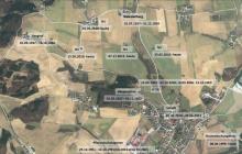
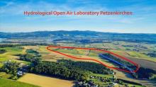
The local aspect of soil protection was dealt with using the example of the hydrological catchment HOAL Petzenkirchen. In the HOAL Petzenkirchen the soil loss since 1945 was quantified. A comparison of the water-related soil losses (= sediment), for the periods 1945-1954 and 2002-2017 showed that the sediment concentrations in the receiving water of the HOAL Petzenkirchen have increased enormously. Although the change in regenerosivity in the catchment has increased significantly in the last two decades, this occurred only after a significant decrease in erosivity in the 1960s and 1970s. This implies that climatic influences have not contributed significantly to the increase in soil loss.
A major contributor to the increase in erosion risk has been, on the one hand, the change in crop composition toward increased cultivation of crops with higher erosion risk. On the other hand - and here we come full circle to the institutional soil protection by the ABB - the natural conditions in the watershed, i.e. the presence or absence of small and many sloughs, e.g. with marginal boundaries, were a very important driver for the increased soil loss to the water bodies.
>> PDF Report Potential analysis ground data - November 2021 (GE)
Photos: ©BAW Petzenkirchen, Hydrologisches Einzugsgebiet HOAL – Hydrological Open Air Laboratory Petzenkirchen
04.11.2025
EUSDR PA10: 12th Danube Participation Day in Sarajevo
more ...30.10.2025
Online-Präsentation BBK-Projekt CNSoil - Zwischenergebnisse
more ...07.10.2025
CatchHedge - Potenziale von Hecken im Zeichen des Klimawandels
more ...16.+17.09.2025
32nd Conference of the Danube Region
more ...12.09.2025
Grundlagen der professionellen Bio-Mandel-Produktion
more ...10.09.2025
Agroforst u. Marktgärtnerei, Symbiose
more ...05.09.2025
Regionales Wiesensaatgut gewinnen mit dem Wiesensamenernter
more ...25.06.2025
Feldtag - StripTill im Bio-Mais im Trockengebiet
more ...25.06.2025
Seminar: Wildbienen- und Nützlingsförderung im Biolandbau
more ...24.06.2025
BOKU Green Plate Forum 3.0
more ...24.06.2025
Die Maulbeere - Kultur, Produktion u.Verwendung
more ...17.06.2025
Frühjahrstagung Österr. Gesellschaft für Agrar- und Umweltrecht (ÖGAUR)
more ...13.06.2025
Seminar: Artenvielfalt in Ackerbauregionen fördern
more ...03.06.2025
Seminar: Keine Angst vor der Ackerdistel
more ...03.06.2025
Agroforstsysteme: Anbau-Modelle der Zukunft
more ...20.05.2025
IDM-Generalversammlung 2025
more ...15.05.2025
Seminar: Unkräuter/Beikräuter erkennen und als Zeigerpflanzen nutzen
more ...13.+14.05.2025
Bodenforum Österreich - Frühjahrstreffen
more ...04.05.2025
Tageskurs: Perma-Veggies - Mehrjähriges Gemüse und essbare Stauden
more ...03.05.2025
Waldgärten-Exkursion
more ...


